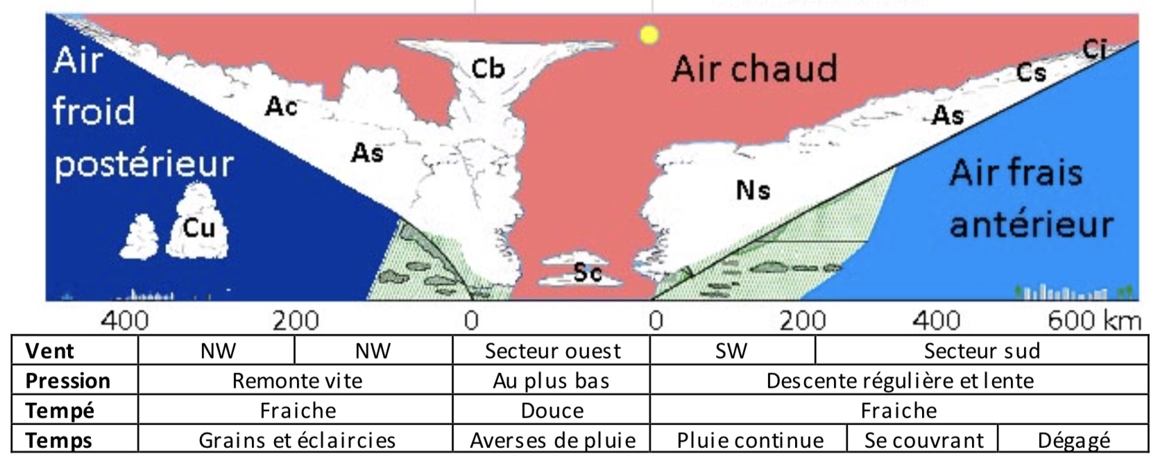
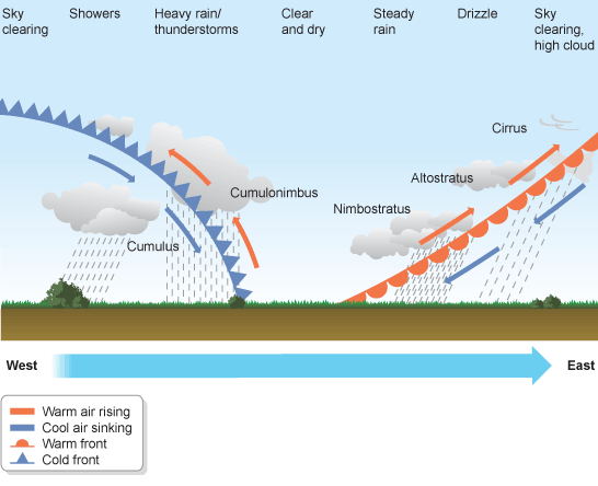
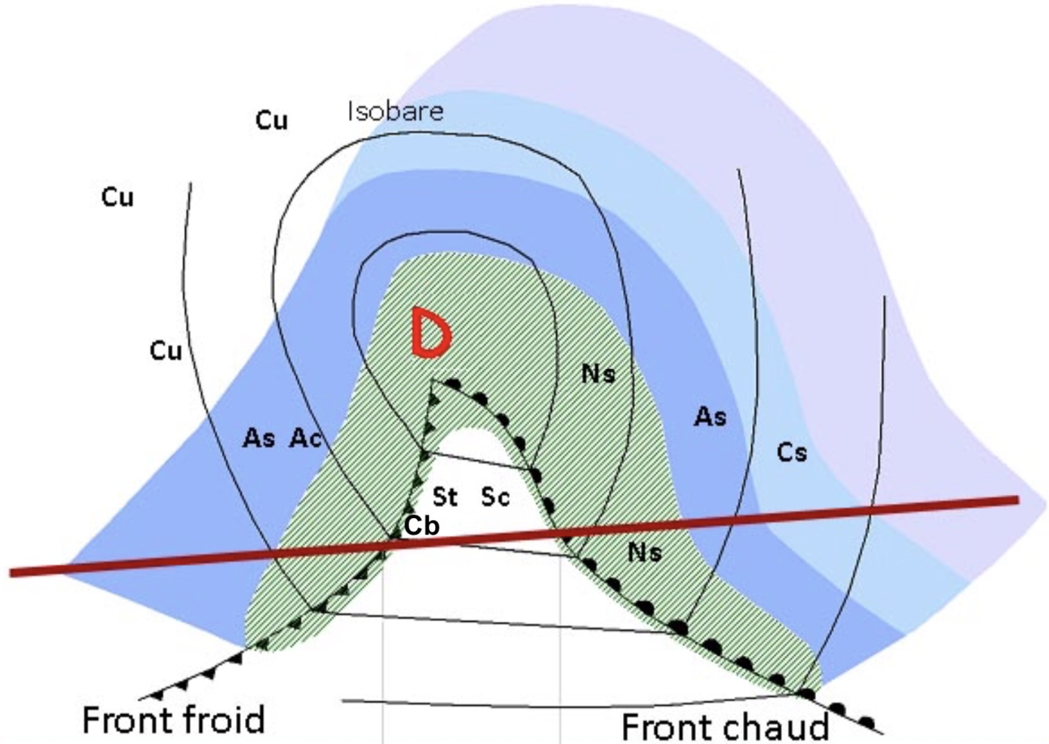
For an observer placed on the right side of the diagram, the cloudy ceiling will sink and become darker and darker accompanied by heavy rain.
Then, in a second time, it will clear and give way to a sky filled with stratocumulus or stratus clouds and a few showers.
This respite will be short-lived and will give way to strong winds and violent showers as the cumulonimbus passes. Thunderstorms are possible.
The situation will then improve to give way to a trailing sky with a few squalls and clearings.
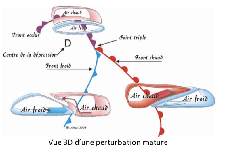
Animated hot front
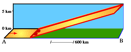
The warm air moves towards colder air.
The warm front is therefore an upwelling front because the air settles on the surface of the cold mass.
It spreads out over a long distance and it is sometimes difficult to note precisely when it passes.
The general impression is that the cloud ceiling is descending and the sky is getting darker. (Nimbostratus Ns type cloud)
The passage between the two air masses takes place over a long distance and it is sometimes difficult to note the exact moment of its passage.
Once the warm front has passed, we enter the warm sector, the zone of mild air between the warm and cold fronts in a frontal low.
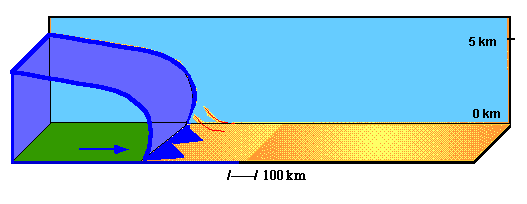
The cold air moves towards warmer air.
The cold front is therefore a descending front because it causes the air to rise on contact with the cold mass.
It is of short distance and it is easy to note with precision the moment of its passage.
It is likely to give strong gusts of wind.
The warm air creates an elevation cloud. (Cumulonimbus type cloud Cb)
Animated cold front
Reproduce the diagram of the arrival of a disturbance
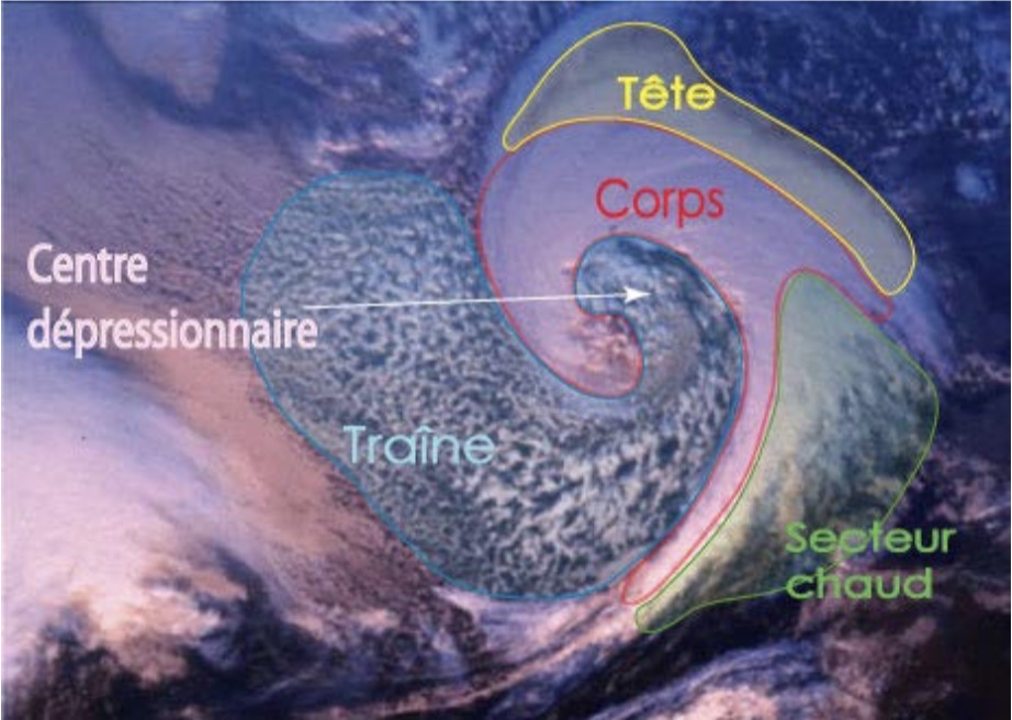
Very often, the cloud structure of a disturbance allows you to distinguish several parts. The head is located in front of the disturbance.
The body corresponds closely to the fronts. The warm sector is the warm air trapped between the warm and cold fronts.
Finally, the trail is located behind the cold front.
Quite often, the low-pressure center can be isolated on satellite photographs, by a less important presence of cloudy masses.
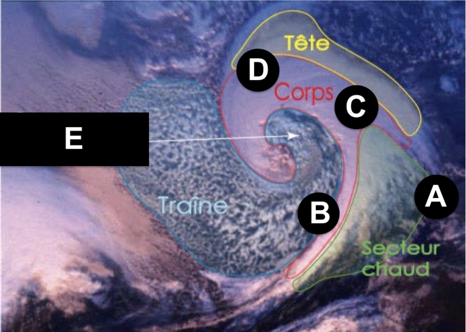
For each letter indicate the corresponding element:
Depression question
Answer
A: Warm front / B: Cold front / C: Triple point / D: Occluded front / E: Depression center